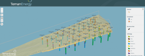
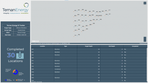
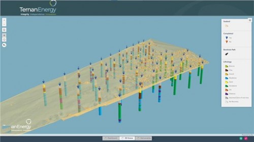
It’s a basic reality of the early phases of offshore wind development that geotechnical and geophysical surveys of the seabed take time. Lots of it. But here at Ternan we’ve created a way for developers to draw insight from seabed surveys in near real time. We sat down with Richard Luker, Principal Geotechnical Engineer at Ternan Energy, to discuss our new project dashboard – Orion – and how it delivers faster, smarter insights for our clients.
What is the new project dashboard?
Essentially, Orion is a web-based tool that shows how geophysical and geotechnical surveys are progressing, with a preliminary visualisation of the data gathered. In essence, clients can see an early stage ground model coming together in near real time as their survey progresses – visualising data such as bathymetry and seabed composition. It’s also possible for us to overlay the preliminary ground model with any existing GIS data the client has from previous surveys.

Who benefits from the project dashboard?
As well as the Survey (or SI) team – Design and Foundation teams, Environmental teams and the Consents team. Orion benefits all stakeholders involved in an offshore wind project, from the marine and technical crew onboard the survey vessel through to the developer’s senior management and procurement team reviewing progress, budgets and costs. Here’s how…
Client benefits: more control, more insight, more agility
There are two major ways Orion can benefit the early stages of an offshore wind development project.
- Making sure that a geotechnical or geophysical survey is completed methodically and comprehensively.
- Enabling stakeholders to react quickly to initial survey findings – helping them to save time and money.
Let’s elaborate. Firstly, Orion gives clear visual oversight on survey progress. You can see what’s been completed, what’s left to complete and the order in which the survey deliverables are being approached. That makes it easy to ensure surveys are completed comprehensively and nothing is missed. Secondly, Orion gives developers a preliminary ground model that can transform the speed at which key decisions are made. Typically it can take many weeks, sometimes months, to create a detailed ground model once a survey has been completed. Orion provides a fundamental visualisation of subsea soil and ground conditions within 24 to 48 hours of it being collected. That makes it easy for developers to see past the raw data and begin making key commercial and design decisions with more confidence. Perhaps you’ll see that boreholes need to be deeper to get the insight you need. Maybe you will learn that a different type of foundation design will be required for your prospective site. Or perhaps you will discover that the seabed composition makes development commercially untenable – allowing you to terminate the survey and save both time and money. A visual representation of your survey – updated every 24 hours – makes for agile decision making, whether it’s changing the design of your development or amending the price you are prepared to offer at auction.
Is Orion easy to use?
Prior to the survey starting, we will set you up with a portal to access Orion, giving you a tour of how it works along with a project team or individual logins as required. We can also customise the way data is displayed according to your priorities – whether your focus is technical, commercial or HSE. Orion has been designed with simplicity in mind, to give easy visual displays of offshore data that anyone can understand.


Want to know more?
To find out more about how Orion works, contact Richard Luker.
